|
FOTOGRAMMETRIA - CARTOGRAFIA - TOPOGRAFIA SISTEMI
INFORMATIVI TERRITORIALI |
||
|
|
Profile
The Company
was founded in 1981, as the sister company of the engineering firm founded by
Geom Alberto Canavesi in 1951. Today we have
the modern instruments update existing topographic maps and support these
services with the latest IT instruments available on the market. From the
early 70’s until the 90’ we had been working in Italy and abroad in
partnership with important Italian and international companies and
multinationals. We developed a series of topographic works to support
masterplans, large property developments, motorways, industrial estates,
dikes, etc. In 1983 we
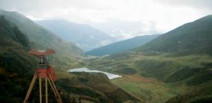
started to develop a large amount of aero photogrammetric work on behalf of
the public sector, with a specific and long term partnership with several
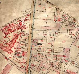
local counties in Lombardy. We
delivered the cartography plan on scale 1:500, 1:1000, 1:2000, 1:5000, in the
first place following the traditional draw design, and later with the support
of a modern plotter. In 1990 we
moved on with the development of a cartography based on numeric system and,
since the early 2000 with a “topographic database”. |
|
CANAVESI S.R.L. Viale
Vittorio Emanuele, 23 – 24121 BERGAMO (Italy)
Tel. +39 035 237680 - email : info@canavesi.it