|
FOTOGRAMMETRIA - CARTOGRAFIA - TOPOGRAFIA SISTEMI
INFORMATIVI TERRITORIALI |
||
|
|
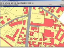
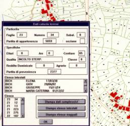
GIS A
geographic information system (GIS) integrates hardware, software, and data
for capturing, managing, analyzing, and displaying all forms of
geographically referenced information. GIS allows us to view, understand,
question, interpret, and visualize data in many ways that reveal
relationships, patterns, and trends in the form of maps, globes, reports, and
charts. GIS
technology can be integrated into any enterprise information system framework
or pre existing data. It also helps you to answer questions and solve
problems by looking at your data in a way that is quickly understood and
easily shared. We also
offer consultation to the public institutions and in the development of their
own GIS. |
|
CANAVESI S.R.L. Viale
Vittorio Emanuele, 23 – 24121 BERGAMO (Italy)
Tel. +39 035 237680 - email : info@canavesi.it